Travel Information

Namibia: best time to visit, entry, travel facts

When Namibia is at its best for safari and motorcycle: dry or wet season, climate month by month, plus visa, vehicle papers and fuel planning before you leave.

View tours
Visa
Visa-free for up to 90 days (DE, AT, CH, EU)
The 90-day stamp is issued automatically on arrival, no advance application needed
Passport validity
At least 6 months valid beyond your departure date, at least 3 blank pages
Best time to travel
May to September (dry season, cool nights, clear tracks)
Currency
Namibian dollar (NAD), pegged 1:1 to the rand, ZAR accepted everywhere
Time zone
CET +1 (no separate daylight-saving shift relative to Germany in summer)
Side of the road
Drive on the left
Helmet & gear
Helmet mandatory for rider and passenger
Main road
B1 (north-south axis) and B2 (Windhoek-Swakopmund) are paved, everything else is mostly gravel
Fuel
Unleaded available in all larger towns, plan petrol stations deliberately on gravel stages
Int'l driving permit
International driving permit recommended, since the German licence isn't issued in English

Game viewing in Namibia: dry season or wet season

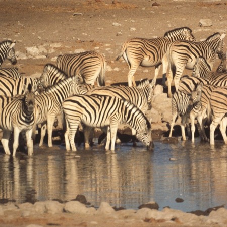
In the dry season the animals stand at the waterholes; in the wet season the Etosha Pan fills with flamingos and the young are born.

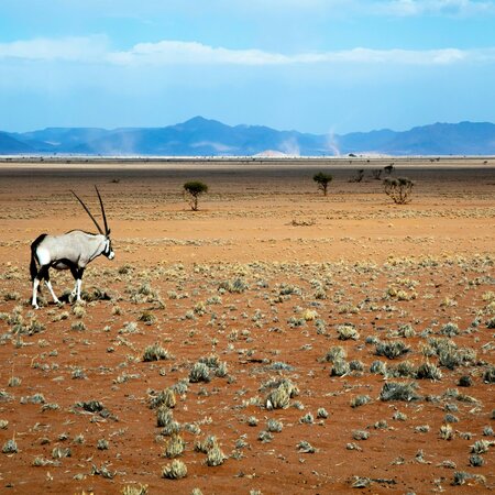
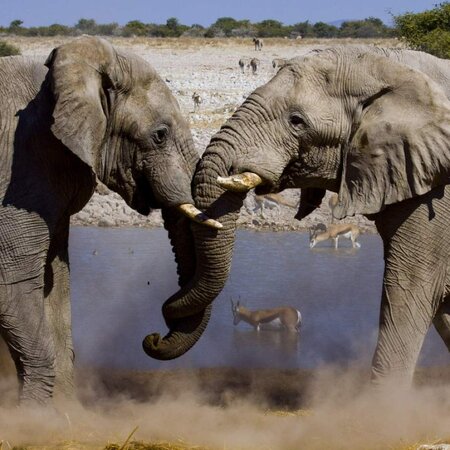
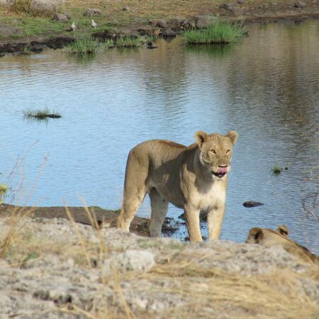
Namibia has no great migration like the Serengeti; the event here is water. From May to October practically no rain falls in Etosha National Park, the puddles in the bush dry out, and elephants, zebras, giraffes, oryx and springbok have to come to the 30-odd waterholes along the tourist roads. At a single waterhole such as Okaukuejo, Halali or Namutoni you then see more animals in one hour than in a whole day of the wet season. The grass is short, the mopane trees are bare, and you can see for hundreds of metres. Lions and hyenas lie in wait near the water, black rhinos come to the floodlit waterholes of the 3 camps at night. You get the most sightings from August to October, when water is scarcest. The price: October is the hottest month, with 34°C by day.

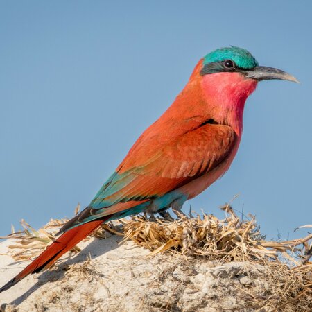
With the first rains in November the animals spread across the whole park, because there is water everywhere. From December to March the grass is tall and green, visibility is often down to 50 m, and the minor roads in the park are soft. In return, springbok and wildebeest calves are born in December and January, and when the pan holds water after heavy rain, which does not happen every year, up to 1 million lesser and greater flamingos breed there, mostly between January and March. On top of that, more than 100 migratory bird species are in the country, among them bee-eaters, cuckoos and storks.

Outside Etosha the same rhythm applies. In Damaraland and the Kaokoveld you follow the desert elephants along the dry riverbeds of the Ugab, Huab and Hoanib, most reliably from June to October, when they keep to the few water points. In the Zambezi Region (Bwabwata, Mudumu, Nkasa Rupara) several thousand elephants gather along the Kwando from July to October, while Nkasa Rupara is mostly flooded and out of reach for vehicles from January to April. On the coast, the seal colony at Cape Cross, with up to 100,000 animals, is there all year; the pups are born in November and December.

Region Jan Feb Mar Apr May Jun Jul Aug Sep Oct Nov Dec
Etosha National Park (waterholes, big game)
Etosha Pan (flamingos, migratory birds)
Damaraland and Kaokoveld (desert elephants)
Zambezi Region (Bwabwata, Mudumu, Nkasa Rupara)
Coast (Cape Cross, Walvis Bay lagoon)
Best sightings Good chances Few sightings

What guests say about their trip to Namibia

★★★★★

Tobias K.

Die Organisation der Namibia Erlebnisreise im Overlandtruck war durchdacht und strukturiert. Die täglichen Abläufe wurden durch regelmäßige Briefings und klare Informationen zum Reiseverlauf unterstützt, beispielsweise beim Besuch der spektakulären Sossusvlei mit Düne 45. Die Gruppengröße von maximal 20 Personen sorgte für eine angenehme Atmosphäre, und...
★★★★★

Alexander R.

Die Routenplanung der Wüstensafari in Namibia ist durchdacht und bietet beeindruckende Etappen wie die Erkundung des Fish River Canyons und die Faszination der Sossusvlei Dünen. Die Kombination aus verschiedenen Unterkunftsoptionen, wie Camping und festen Zelten, und die maximale Gruppengröße von 20 Personen ermöglichen eine intime...

Alexander R. Lodge Safari in Namibia

★★★★★

Michael N.

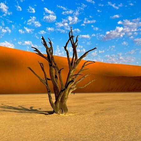
Die Betreuung durch das qualifizierte Team auf der Kleingruppenreise durch Namibia war durchweg professionell und ansprechend. Während der Tagestouren zu Düne 45 und Deadvlei sind die Guides klar auf die unterschiedlichen Interessen der maximal 12 Teilnehmer eingegangen. Regelmäßige Briefings vor den Aktivitäten sowie individuelle Tipps...

Weather and climate in Namibia, month by month

The table shows Okaukuejo in Etosha National Park, the region where most safaris spend the bulk of their days. Namibia lies in the southern hemisphere: summer is December to February with 31 to 33°C and 7 to 10 rain days a month, winter is June to August with 25°C by day and 7°C at night. Rain falls almost only from November to April, around 400 mm over the whole year, usually as a late-afternoon thunderstorm that is over within 1 hour.

The regions differ a great deal. Windhoek at 1,650 m sits at 6°C on winter nights; in the south around Keetmanshoop and the Fish River Canyon the thermometer drops to 2°C in July and climbs above 38°C in summer. Swakopmund and the whole coast stay at 15 to 25°C all year thanks to the cold Benguela Current, with fog on up to 100 days a year. The Zambezi Region in the northeast, with 600 to 700 mm of rain and 60 to 70 percent humidity in February, is the wettest part of the country.

Month Max °C Min °C Rain days Humidity % Sun hours
Jan Wet season 33 19 9 55 8
Feb 31 18 10 60 8
Mar 30 17 8 55 8
Apr 29 14 3 45 9
May Dry season 27 10 1 35 10
Jun 25 7 0 30 10
Jul 25 7 0 28 10
Aug 28 9 0 25 10
Sep 32 14 0 22 10
Oct 34 18 2 25 10
Nov Wet season 34 19 5 35 9
Dec 33 19 7 45 8

Best Time to Travel by Region in Namibia

The south is rideable practically all year round; in the northeast, the rainy season decides between muddy or flooded tracks.

8 Ideal
Best time to travel
May to September (dry season)

Cool, clear dry season with the best track conditions nationwide; nights in the south and on the highland can drop below 0°C.

Region Jan Feb Mar Apr May Jun Jul Aug Sep Oct Nov Dec
Namib and the South (Sossusvlei, Fish River Canyon, Lüderitz)
Centre and North (Damaraland, Etosha, Windhoek axis)
Zambezi Region / Caprivi Strip (Northeast)
Ideal Doable Not passable

Namibia is mostly desert and semi-desert, so it's not rain that decides your comfort but track condition and river crossings. In the south (Namib, Sossusvlei, Fish River Canyon), rideability barely changes over the year - here, heat is what matters most: from December to February, daytime temperatures often top 38°C, and that is the real limit for long stages on a motorcycle and for coolant/rider hydration, not the road surface.

In the centre and north (Damaraland, Etosha), clay-pan tracks and side roads become slippery and sometimes trackless after rain (January to March), but the main B and C routes stay rideable year-round. The northeast (Zambezi Region/Caprivi) gets the most rain in the country, up to 700 mm a year, concentrated between December and March; side routes to wetlands and game reserves can then become temporarily impassable due to flooding from the Kwando and Zambezi, though the paved B8 (Trans-Caprivi Highway) generally stays open.

Dry season (May to September) is therefore the most reliable travel time nationwide: firm tracks, few insects, good visibility for spotting wildlife on the road at dusk. October/November are the hottest months before the first rain, often with dust and afternoon heat storms.

Best time to go, depending on what you are after

Seeing wildlife: July to October

In these 4 months all the game in Etosha hangs around the waterholes, the grass is grazed down and the view is clear. At the Okaukuejo waterhole you often count 5 to 8 species at once in one afternoon, and rhinos come under floodlight at night. In Damaraland the desert elephants are in the Hoanib and Ugab, in the Zambezi Region along the Kwando. The downside: September and October are hot at 32 to 34°C, and the lodges inside the park are booked out 6 to 9 months ahead.

If you cope badly with heat: May to August

25 to 28°C by day, dry air, no thunderstorms, hardly any mosquitoes: the Namibian winter is the gentlest time for long days on the road and for anyone who sleeps badly above 35°C. Expect cold nights, 7°C in Etosha, down to 0°C and below in the south and in Windhoek, so pack a fleece and a beanie for the 6 a.m. game drive. Sightings are already good, though not yet as dense as in September. Malaria is hardly an issue at this time, even in the north.

The most popular time: July to September

Dry season, game at the waterholes, European summer holidays: these 3 months draw the most visitors. You notice it at the camps in Etosha and Sesriem, which are often full half a year ahead, in the queue at the Sossusvlei gate at 6 a.m., and in higher lodge rates. If you are flexible, take June or October: the same conditions, far fewer vehicles at the waterholes, and the short group trips of 10 to 12 days run through both months anyway.

Birds and green scenery: January to March

After the rains Etosha stands in grass, the Kalahari to the east is in flower, and the Etosha Pan can be a shallow lake for weeks. Flamingos and pelicans breed then, and more than 340 bird species are about in the park, among them bee-eaters, the red-chested cuckoo and white storks from Europe. Big game is scattered and harder to find, but the springbok, wildebeest and zebra calves are only a few weeks old. Storms come in the late afternoon, and some minor roads are closed.

For photographers: April, May and October

April and May deliver the clearest air of the year: the dust has been washed out, the grass is still green, the waterholes fill up with animals again, and the sun sits lower than in high summer. October is the opposite direction: a dusty white pan, elephants backlit at the waterhole, heat shimmer from 10 a.m. At Sossusvlei only the first hour after sunrise counts in any month; the gate opens at sunrise, around 7:15 in June and around 5:45 in December.

Visa and Entry Requirements

German, Austrian and Swiss nationals enter visa-free, but the passport must remain valid beyond the departure date.

German, Austrian and Swiss nationals automatically receive a 90-day stamp on entering Namibia; there is no need to apply for a visa in advance. What is required is a passport valid for at least 6 months beyond your planned departure date, with at least 3 blank pages for entry and exit stamps - both are checked at the border, and a passport that falls short leads to refusal.

A return flight ticket or proof of onward travel is requested at some border crossings, so keep it to hand (a digital copy is usually enough). The 90-day stamp applies per entry; anyone wanting to stay longer must extend it at the Ministry of Home Affairs and Immigration in Windhoek - there is no informal extension at the border.

On a round trip that crosses Namibia's borders more than once (for example South Africa, Namibia, Botswana, Namibia), each entry counts afresh, as long as the 90 days within the calendar year are not exceeded. Children need their own passport, and minors travelling without both parents have their consent letters and birth certificates checked.

Visa typeStayCostWhere to applyValidity
Tourist stamp on entry90 daysfreeAny border crossing / airportPer entry, max. 90 days per calendar year
Extension of the stampAt the authority's discretionFee payableMinistry of Home Affairs and Immigration, WindhoekMust be applied for before the 90 days expire
Temporary Import Permit (own motorcycle, land border)Usually tied to the 90 daysFee payable, paid at the borderBorder crossing (NamRA counter)Valid for the imported vehicle, non-transferable

Entering with Your Own Motorcycle

Namibia belongs to the SACU, so a Temporary Import Permit is enough overland; a Carnet de Passages is only required if you ship the bike.

Namibia is a member of the South African Customs Union (SACU, along with South Africa, Botswana, Lesotho and Eswatini). Vehicles entering overland from a SACU country therefore don't need a Carnet de Passages. Anyone shipping their motorcycle overseas and importing it through a port, on the other hand, needs a Carnet without exception - without it, the vehicle cannot be cleared at customs.

At every land border, a Temporary Import Permit (TIP) is issued instead, fee-payable and tied to the imported vehicle, usually for the duration of the tourist stamp (up to 90 days). You need to carry the original vehicle registration document, your driving licence, and, for a borrowed or rented motorcycle, a notarised power of attorney from the vehicle's owner - without it, the TIP is refused at some borders.

Third-party vehicle liability cover is levied at the border in the form of the Cross Border Charge / Road Safety Levy, which covers damage to third parties within Namibia and is paid directly at the counter (in cash, NAD or ZAR). A European green card is not recognised.

The classic land borders for a round trip are Vioolsdrif/Noordoewer (from South Africa), Ariamsvlei (also South Africa) and Ngoma/Mohembo (towards Botswana/Zambia in the Caprivi). All three are well-developed border posts with predictable processing times, though noticeably slower on weekends and public holidays.

A rental motorcycle locally (Windhoek, Swakopmund) is the simpler option for anyone who doesn't want to bring their own machine: no border formalities, no insurance question, but a limited choice of models and lead time needed for booking.

0 / 6
No Carnet needed at a land border within the SACU, but it is mandatory if you ship the bike. Without a notarised power of attorney, a motorcycle not registered to the rider is often turned away at the TIP counter.

Driving Licence and Documents

A valid motorcycle licence is legally sufficient, but an international driving permit is the more practical choice at checkpoints.

Namibia recognises a valid foreign driving licence for tourists, provided it is issued in English. The German, Austrian and Swiss card-format licence is not, so in practice checkpoints and motorcycle rental consistently ask for an International Driving Permit (IDP) under the Vienna Convention, in addition to your national licence, never as a substitute for it.

The IDP is applied for before the trip at the relevant licensing office (in Germany, for example, at the Straßenverkehrsamt), usually issued the same day. Always carry both documents on the trip - the IDP alone is invalid without the national licence.

At checkpoints, especially around Windhoek, you will be asked for your licence, vehicle papers (registration + TIP) and sometimes your passport. The checks are routine, not harassment; a complete set of documents usually makes them a two-minute matter.

0 / 4

Tracks and Route Segments at a Glance

Namibia has one of the best gravel road networks in Africa, but the rule of thumb still applies: slow down, and take fuel planning seriously.

Three letters decide the surface: B-roads are paved and form the national main network (B1 north-south, B2 Windhoek-Swakopmund, B4 Keetmanshoop-Lüderitz), C-roads are regularly graded gravel tracks, wide enough for oncoming traffic, and D-tracks are narrower, unpaved connecting roads with noticeably more washboard and loose ground. A speed limit of 100 km/h applies on gravel, but 80 km/h on good and 60-70 km/h on poor track surfaces is recommended - washboard sections don't forgive excess speed.

The biggest danger isn't the surface changes themselves, but underestimating the distances between petrol stations: on the classic southern routes, there are 250-340 km stretches with no fuel available, which many first-time visitors plan too tightly.

Tyre pressure is the second big lever on gravel: many riders experienced with Namibia noticeably lower the pressure on loose ground, which improves traction and comfort on washboard, but costs some range on hard-packed track. Before multi-day stages away from the B-roads, it's worth checking current route reports, especially after rain in the north.

1
Windhoek - Sesriem/Sossusvlei (C24/C19)
320 km

Well-graded gravel track (C-class), wide enough for oncoming traffic

After rain
Briefly slippery after heavy rain, no structural closures known
Realistic daily distance
320 km, approx. 5-6 hours riding time
Fuel stops
Next petrol station right in Sesriem, none before that
Passes
none
Permits
NWR park fee at the Sesriem Gate for Namib-Naukluft National Park
2
Sesriem - Solitaire - Walvis Bay/Swakopmund (C19/C14)
340 km
100% gravel

Continuous gravel track, washboard in places

After rain
Some sections soften after rain, reduce speed significantly
Realistic daily distance
up to 340 km feasible in one day, but counts as a long day's stage
Fuel stops
Only fuel stop en route: Solitaire at km 83 from Sesriem, then 257 km with no petrol station to the coast
Passes
none
Permits
none
3
Lüderitz - Aus (B4)
200 km
100% paved

Paved, good condition, little traffic

After rain
uncritical
Realistic daily distance
200 km, approx. 2.5 hours
Fuel stops
Petrol stations in Lüderitz and Aus
Passes
none
Permits
Restricted-area permit if visiting Kolmanskop/Diamond Area 1 off the through-route
4
Aus - Fish River Canyon (C13/C10/C12)
260 km
100% gravel

Gravel track, well maintained, washboard in places

After rain
Fords on the Fish River can briefly swell after heavy rain
Realistic daily distance
260 km, approx. 4 hours
Fuel stops
Only in Aus, no petrol station at the canyon itself
Passes
none
Permits
NWR permit for viewpoints and hikes at Fish River Canyon
5
Spitzkoppe - Uis - Twyfelfontein/Brandberg (D and C tracks)

Mix of C and narrower D tracks, heavily washboarded in places

After rain
Some D tracks and riverbeds (Ugab, Aba-Huab) can be washed out or carrying water after rain
Realistic daily distance
150-200 km already counts as an ambitious day's stage here
Fuel stops
Only in Uis and Khorixas, none in between
Passes
none
Permits
Entry fee/mandatory guide for the rock engravings at Brandberg (White Lady) and at Twyfelfontein (UNESCO World Heritage Site)
6
Windhoek - Etosha, Anderson Gate (B1/C38)
430 km
93% paved 7% gravel

Almost entirely paved, last 28 km before the Anderson Gate is gravel in good condition

After rain
The 28 km of gravel can be slippery after rain, otherwise uncritical
Realistic daily distance
430 km, approx. 5 hours of riding time
Fuel stops
Along the B1 every 100-150 km (Okahandja, Otjiwarongo, Otavi)
Passes
none
Permits
NWR park fee at the Anderson Gate for Etosha

Fuel and Petrol Stations

Unleaded is standard - the real issue is range: on the southern routes, up to 340 km lie between two petrol stations.

Unleaded petrol (95 octane) and diesel are reliably available in all larger towns and along the B-roads, usually with card payment. Away from them, especially on the C-tracks in the south and in Damaraland, it gets thin: the petrol station in Solitaire is the only one over the 340 km between Sesriem and the coast, and Aus is the last one before the Fish River Canyon.

At small petrol stations in remote towns, card terminals don't always work reliably (network outages, offline periods), so cash in NAD or ZAR belongs in your luggage for every stage. A reserve canister (5-10 litres) is not a luxury on the longer southern routes and in Damaraland, but the usual precaution, one that local rental operators also expect.

Rule of thumb for trip planning: top up again at the latest once you're at half a tank, whenever more than 200 km lie between two known petrol stations, and don't push your range to the last drop - gusts of wind and sandy tracks noticeably increase consumption compared to a tarred road.

FuelAvailability
Unleaded 95Standard, available at all B-road stations
DieselJust as widespread as unleaded

Safety and Emergency Numbers

112 doesn't work reliably everywhere - the national numbers are the more reliable choice.

The nationwide police number 10111 and the ambulance number 10177 are the primary emergency numbers in Namibia. 112 also works from most mobile networks, but is not guaranteed to be reachable in signal gaps away from towns. In Windhoek, the central point of contact for ambulance and fire services additionally runs through its own local number.

On remote gravel stages (Damaraland, the south, Kaokoveld), mobile coverage is absent for stretches at a time, so a satellite tracker or communicator with an SOS function is a sensible addition for groups away from the B-roads - not a substitute for careful riding.

Wildlife crossing roads is a real risk on Namibia's roads, especially at dusk and at night: kudu, zebra and cattle cross unlit roads without warning. Night riding outside towns should therefore be avoided as a rule.

Health and Vaccinations

Malaria risk in the north and northeast; standard travel insurance often doesn't cover larger engine capacities.

The south, the centre and the coast (Windhoek, Sossusvlei, Swakopmund, Fish River Canyon) are considered malaria-free or very low-risk. In the north and northeast (Etosha, Kaokoveld, Zambezi Region/Caprivi), there is a malaria risk, mainly during and after the rainy season (November to June); chemoprophylaxis, or at least emergency medication after consulting a travel health centre, makes sense for these stages.

Basic medical care is good in Windhoek and the larger towns, but thin across the country: the nearest doctor or hospital can be several hours' drive away on remote stages. A well-stocked first-aid kit, including dressings for burns and grazes, belongs on every motorcycle trip away from the towns.

0 / 5
Most standard travel insurance policies exclude riding motorcycles over 125cc. Before booking, check whether medical repatriation and motorcycling are explicitly covered.

Money and Paying Locally

The Namibian dollar and South African rand run side by side 1:1; cards work in towns, cash counts everywhere else.

The Namibian dollar (NAD) is pegged 1:1 to the rand (ZAR); ZAR notes are accepted everywhere as legal tender, while NAD is not accepted in South Africa. In Windhoek, Swakopmund and larger towns, card payment works reliably at petrol stations, restaurants and supermarkets. At small rural petrol stations and lodges, card terminals are sometimes offline or don't work at all, so cash is often the only option there.

Cash machines exist in the larger towns along the main routes, but none on multi-day gravel stages away from them. Plan enough cash in small notes for every stage, especially for park fees, petrol stations and small lodges along the way.

Network Coverage and SIM Card

MTC covers most people, but not the land area: on gravel stages in the south and Damaraland there are long signal gaps.

MTC is Namibia's largest mobile network operator and, by its own figures, covers around 97% of the population - but given Namibia's low population density, that says little about land coverage: on gravel stages in the south, in Damaraland and in the Kaokoveld, the network drops out for hours at a stretch. A local prepaid SIM (MTC or Telecom Namibia) is easy to get at the airport and in towns, and noticeably cheaper than roaming in populated areas.

For groups travelling away from the B-roads, a satellite communicator (e.g. with an SOS function) is the more reliable safeguard than the mobile network.

How to Behave on the Road

Driving on the left, wildlife crossings and farm gates are the three things most likely to catch you out on Namibia's roads.

Namibia drives on the left, so the motorcycle has to observe right-of-way rules accordingly, and roundabouts are taken anticlockwise. Many farm roads and side tracks cross fenced grazing land through gates (farm gates): a gate found open is left open, and one found closed is closed again after passing through - among farmers this is a firm rule and is taken seriously.

Photographing people, especially in traditionally living communities in the north (such as Himba settlements), only after asking and usually for a small fee. Don't ride off-road on farmland or in game reserves without permission - it is usually private property.

What Namibia Adds to Your Standard Kit

Not a generic motorcycle packing list rehash, but what this route specifically demands.

0 / 6

Photos from Namibia

Joe Küster
Author
Joe Küster
Founder & Creative Engine of Overcross

"Jack of all trades, almost all!" The driving force and idea machine behind Overcross.

Languages: de, en
×

Send request

Adventure

How did you
hear about us?

Adventure truck Road path Palm tree
Ask a Route Expert

How do you want to travel?