Everything you need to know about Zambia

Travel map of Zambia by tour operator Overcross
- General information for Zambia
- Climate in Zambia
- Geography in Zambia
- Flora and Fauna in Zambia
- National parks and nature conservation in Zambia
- Population in Zambia
- Politics and economy in Zambia
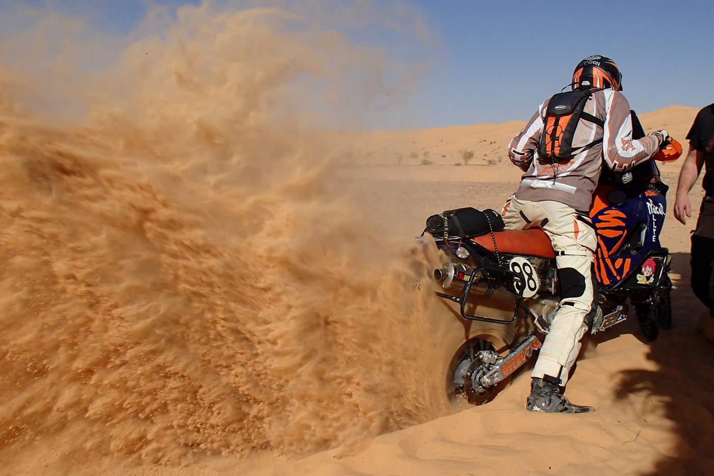
- Transport network in Zambia
- Cities and regions in Zambia
- Culture and sights in Zambia
- Public holidays in Zambia
- Medical information for Zambia
- Travel advice for Zambia
- Foreign representation in Zambia
- Information sources for Zambia
1. General information for Zambia
| Continent: | Africa |
| Geographical location: | Southern Africa, west of the central African Rift Valley, located in the southern hemisphere |
| Highest elevation: | Mafinga Mountains (2339 m.a.s.l.) |
| Longest river: | Zambezi (approx. 2500 km) |
| Form of government: | Republic |
| System of government: | Presidential system |
| Languages: | English, various Bantu languages |
| Neighboring countries: | Angola,Namibia, Botswana,Zimbabwe,Mozambique, Malawi and Tanzania |
| Capital: | Lusaka |
| Area: | Approx. 752,614 km² |
| Population: | Approx. 19,000,000 people (2023) |
| Population density: | 25 inhabitants per km² |
| Religions: | Christians 98%, Muslims 0.5%, others Bahai, Hindus, African traditional religions |
| Currency: | Kwacha (ZMW), 1 Euro is approximately 26.3 MWK (as of 2023). You can find the current exchange rate at oanda.com |
| Climate: | Tropical with three seasons |
| Time zone: | UTC + 2 |
| Area code: | +260 |
| Country code: | ZM, ZMB, 894 |
| Electricity: | In Zambia, socket types C, D and G are used. The mains voltage is 3 x 230V with 50Hz alternating interval. A travel adapter is advantageous. An overview of the sockets and plugs used in our travel countries can be found at wikipedia.de |
2. Climate in Zambia
Zambia has a tropical climate, which is more temperate due to the country's terrain mostly lying above 1000 m a.s.l. There are three seasons in Zambia: a cool and dry season from May to September with temperatures between 15 and 27 °C, a hot and dry season in October and November with temperatures between 24 and 34 °C, and a hot and humid rainy season from December to April with average temperatures between 27 and 39 °C, which can be accompanied by severe tropical storms.


3. Geography in Zambia
Zambia borders to the north and northwest on the Democratic Republic of Congo, to the west on Angola, to the south on Namibia, Botswana and Zimbabwe, and from southeast to northeast on the countries of Mozambique, Malawi and Tanzania.
Zambia's 752,614 km² territory is located mostly on gently undulating plateaus between 1000 and 1400 meters in height. In northern Zambia, on the floor of a gigantic volcanic crater approx. 1.8 billion years old, lies the Bangweulu basin. To the south is the Copperbelt plateau, to the west the Luapula Valley, and to the north the Mporokoso mountains. To the east, the Bangweulu basin is bounded by the Muchinga mountains, along which the Luangwa Valley runs from north to south, and to the east it is bounded by the Mafinga Hills, where the country's highest point is located, the Mafinga, with 2339 m a.s.l. Western Zambia, with the source area of the Zambezi, is a flat sandy region of the Kalahari Desert, which gently slopes downward to the south. Only along the Zambezi escarpment are there dramatic reliefs.
Northern Zambia or the Bangweulu basin drains via the Luapula into Lake Mweru and from there through several intermediate rivers finally into the Congo. The rainfall over the rest of Zambia's territory is drained by the river systems of the Kabompo, Kafue and Luangwa into the Zambezi, which forms the country's largest river.

The Victoria Falls seen from above
4. Flora and Fauna in Zambia
The Zambian high plateau is covered with a low, semi-evergreen dry woodland savannah, known as the Miombo, where trees intermingle with a closed grass layer. Predominant tree species are acacias, baobabs, and thorn bushes.
Natural grasslands form another vegetation zone in Zambia in the form of so-called dambos with flat, treeless landscapes, which are usually entirely covered with grass and, due to abundant rainfall and lack of drainage, are often heavily waterlogged and form fertile ground for swamp forests. In addition to grasses and flowering plants, a wide variety of orchid species can be found in the dambos.
Mopane forests line the river plains of the Zambezi and Luanga in the south of Zambia. Besides mopane, baobabs, crocodile trees, and euphorbias also grow here. Kalahari dry forest occurs regionally limited in the western parts of Zambia influenced by the Kalahari.
The wildlife of Zambia, which can be particularly well observed in the many national parks, includes not only the African-typical mammals but also snakes, various bird species, and reptiles, especially crocodiles. Among the mammals, herds of buffaloes and elephants, lions, leopards, rhinoceroses, giraffes, zebras, cheetahs, wild dogs, baboons, hippos, antelopes, hyenas, kudus, and flying foxes are represented.
5. National Parks and Nature Conservation in Zambia
There are a total of 19 national parks in Zambia, but not all of them are maintained and therefore differ in their opportunities for wildlife observation. The most worthwhile ones are:
South Luangwa National Park
South Luangwa National Park is the best-known national park in Zambia and covers an area of about 9,050 km². Due to its rich wildlife, the park located in the Luangwa river valley is Africa's most popular national park for photographic safaris. The vegetation is characterized by miombo woodland. Animals that can be seen here include giraffes, the Cookson's wildebeest and Crawshay's zebra, large herds of elephants and buffaloes, Nile crocodiles and hippos. The park has a dozen lodges and camps of every category, as well as an airport in the town of Mfue.
Luambe National Park
The 300 km² Luambe National Park is also located in the Luangwa Valley between South Luangwa and North Luangwa National Parks and consists mainly of a flat plateau with areas of dense vegetation, scattered lagoons and mopane woodlands, but also open grasslands. The ever-changing course of the Luangwa constantly creates new sandbanks and lagoons, which shape the unique ecological system of this area with its unique flora and fauna. Due to inadequate surveillance and lack of infrastructure, Luambe National Park, which was almost completely poached out in the 1970s and 1980s, remained undeveloped and neglected for a long time and is therefore not as attractive for wildlife observation as the two neighboring national parks. However, the park is now increasingly being developed for tourism, and a lodge already offers exclusive accommodation in the very scenic park.
North Luangwa National Park
North Luangwa National Park is a 4,636 km² nature reserve located north of the South Luangwa National Park on the Luangwa River. This national park has less variety and density of wildlife than South Luangwa National Park and is wilder and less developed, best visited with a local safari provider. The park is only open from June to October. During the rainy season, access to the park is impossible. There are three rudimentary camps, but at the moment they can only accommodate a few people, as tourist development is still in its early stages. The terrain alternates between mopane forest, riparian forest along the river, open grassland, wide floodplains and acacia thickets. To the east lies the Muchinga Mountains, from which numerous streams flow into the Luangwa.
Nsumbu National Park
Nsumbu National Park covers 2,000 km² and includes a 100-kilometer-long shoreline on the southwestern part of Lake Tanganyika at the very north of Zambia. The park features wide sandy beaches, high granite cliffs, quiet bays, and dark valleys, one of which has been cut 300 meters deep by the Lufubu River, which forms the eastern boundary of the park and flows into the lake. The vegetation mainly consists of combretum thickets, wild figs, and umbrella acacias. The populations of the animals living in Nsumbu National Park are gradually recovering, including sable antelope, wildebeest, eland antelope, impalas, bushbucks, waterbucks, reedbucks, zebras, buffaloes, elephants, lions, leopards, warthogs, hyenas, jackals, crocodiles, and hippos. In addition, there are several large bird species such as flamingos and fish eagles.
Nsumbu National Park is difficult to reach from Lusaka, which is 1,363 kilometers away. Charter flights are possible to Kasaba Bay or Nkamba Bay, as well as boat transfers from Mpulungu. In both cases, onward transportation to the national park must be organized.
Lower Zambezi National Park
The Lower Zambezi National Park encompasses 4,092 km² of land along the Zambezi River southwest of the Luangwa estuary and offers numerous lodges and camps as well as tours by car and boat. The area north of the immediate Zambezi floodplain is so mountainous that access by road is virtually impossible and also impassable for animals. The riverside landscape is characterized by islands, sandbanks, and ponds, which change depending on the water level of the Zambezi. Drier areas are covered by forests of mahogany, ebony, baobab, and wild fig trees. The Zambezi valley is bordered to the north by steep cliffs.
In the dry season, large numbers of animals gather at the remaining ponds, which are the only water sources in the area. The region is therefore popular for observing large animals such as the African elephant, African buffalo as well as leopards and cheetahs. Numerous Nile crocodiles and hippopotamuses retreat to the few remaining bodies of water during the Zambezi’s drying in summer. A visit to the national park is therefore recommended, not only because of easier passability in the Zambian summer.
Mosi-oa-Tunya National Park with Victoria Falls
Mosi-oa-Tunya National Park ("Thunder Smoke National Park") with the unique Victoria Falls is located at the very south of Zambia on the border with Zimbabwe and has been part of the UNESCO World Heritage Site of the same name since 1989. It covers an area of 66 km² about twelve kilometers upstream along the Zambezi, which at Victoria Falls drops 140 meters over a width of two kilometers with up to 500 million m³ water per minute. The spectacle of water and mist gave the park its African name. The park offers good opportunities for observing wildlife such as antelope, zebras, giraffes, elephants, and rhinoceroses and is accessible by normal cars.
Kafue National Park
Kafue National Park is, at 22,400 km², the largest national park in Zambia. The park, located in western Zambia, includes the banks of the Kafue and its tributaries Lufupa and Lunga and is home to the Itezhitezhi Reservoir, which regulates the water level of the downstream Kafue Dam. In the north of Kafue National Park is the Lufupa Forest, containing the Zambezi teak tree, which is much sought after for railroad ties and parquet floors due to the hardness of its wood, but now greatly depleted. In addition, extensive open wetlands, most notably the Busanga Plains, characterize the landscape. In the south, the forest gradually changes into bushland, with the landscape increasingly taking on the character of the surrounding Kalahari. Here the Nazhila Plain is considered particularly attractive.
Kafue National Park is home to one of the last viable populations of African wild dogs. Other large mammal species in the park include lions, spotted hyenas, leopards, impalas, pukus, warthogs, plains zebras, blue wildebeests, hartebeests, red lechwe, kudus, waterbucks, bushbucks, crowned duikers, and oribis. Buffaloes, sable antelope, and roan antelope are more rarely observed. The birdlife of the national park includes, among others, the endangered fig barbet.
Sioma Ngwezi National Park
The 5,000 km² Sioma Ngwezi National Park is located in Zambia’s Western Province on the banks of the Cuando River at the border with Namibia. It can be reached from Livingstone via a well-paved road through Sesheke and the Zambezi bridge. The park consists of teak forests, open bushland, and Kalahari vegetation. To the south, it is adjacent to parks in Namibia and Botswana. Wildlife includes 3,000 elephants, cheetahs, zebras, and especially antelope: puku, impala, roan, sable, kudu. The animal population has suffered greatly due to the civil war in neighboring Angola and is only slowly recovering. There are no visitor facilities in the park, but day tours can be arranged from some lodges on the nearby Zambezi.
Blue Lagoon and Lochinvar National Parks
These two national parks, which lie opposite each other in the Kafue floodplains, are also known as the Kafue Flats and cover an area of about 500 km². The north of the national park is characterized by swamps and lagoons. To the south, a grassland with thorn bushes, palms, and termite mounds adjoins, which transitions into miombo woodland with acacias. The wildlife park, which was founded in the 1990s by the World Wildlife Fund for conservation purposes on a former military restricted area, is still in the development stage for tourism. On its flat terrain of woodland, lagoons, and floodplains, large herds of lechwe antelope graze. Other animals that can be observed include buffaloes, zebras, oribis, wildebeest, kudus or water kudus, baboons, hyenas, leopards, and striped jackals. Over 450 bird species have already been counted in the area. The hot springs of Gwisho with water temperatures between 60 and 90 °C are also worth seeing.
Other national parks and reserves in Zambia include:
Isangano National Park, Kasanka National Park, Lavushi Manda National Park, Liuwa Plain National Park, Lukusuzi National Park, Lusenga Plain National Park, Mweru-Wantipa National Park, Nyika National Park, Sioma Ngwezi National Park, West Lunga National Park, Bangweulu Wetlands, Luangwa Valley Game Reserve
6. Population in Zambia
Zambia now has about 19 million inhabitants and is one of the countries with the highest population growth worldwide. The predominantly black population is largely composed of Bantu ethnic groups (Bemba, Rotse, Tonga, Nyanja-Chewa, Nsenga, Tumbuka, Ngoni, Lala, Kaonde, Namwanga, Lunda, Mambwe, Luvale, Lamba, Ushi, Lenje, Bisa, Mbunda, Luba). A small minority includes population groups of Indian and European descent. Zambia is among the countries with the highest HIV infection rates.
Almost all inhabitants are Christians, only 0.5% of the population belong to the Muslim faith. In addition, there are African religions such as that of the Tumbuka with the Vimbuza cult. These possession cults are collectively referred to as Mashawe in Zambia. A small minority belong to the Bahai as well as Hindus and Buddhists. Among Christians, 75% are Protestant (including Anglicans, followers of the Pentecostal movement and the New Apostolic Church) and 20% Roman Catholic.
Although English is the official administrative and business language in Zambia, only 1.7% of the population speak English as their mother tongue. The rest of the population communicates in a total of 43 different Bantu languages, with Bemba and Nyanja especially having established themselves as lingua francas.
7. Politics and Economy in Zambia
According to the constitution, which was established after independence from Great Britain in 1964 and last amended in 1991, Zambia is a presidential republic in the British-influenced Commonwealth of Nations. It was not until 1991 that the introduction of a multi-party system was decided, along with the simultaneous removal from office of the incumbent president Kenneth Kaunda, which replaced the previously led quasi-dictatorship after massive protests by the civilian population and international patrons. The parliament has 156 members, who, like the president, are newly elected every 5 years. The president, at the head of the executive, who is also the commander-in-chief of the armed forces and prime minister, leads the cabinet and can be re-elected once.
The system of government, which consists of both democratic and authoritarian elements, is assessed as partly free according to international observation. Zambia is a member of the Southern African Development Community (SADC), the Common Market for Eastern and Southern Africa (COMESA), the African Union, as well as the Commonwealth of Nations.
Agriculture and mining are Zambia's main economic sectors. Particularly in the Copperbelt region, there are significant deposits of copper and cobalt, which are mined and smelted. In the central region around the city of Kabwe, tin and lead mining are also carried out. The mining products copper, cobalt, lead, zinc and also gemstones contribute almost 80% of Zambia's export revenue. However, only 14% of Zambia's population is employed in mining. The remaining residents live more than 80% from agriculture. Despite its wealth of mineral resources and considerable economic efforts, Zambia remains one of the poorest countries in the world. Recently, numerous municipal projects in Zambia are being initiated by Chinese investors (e.g., road construction projects), which are partially realized with Chinese labor and at reduced quality. The long-term benefit of such projects for Zambia and its economy is discussed controversially.
8. Transport network in Zambia
In Zambia, traffic drives on the left. Although the main connecting roads between the large cities are paved or at least gravelled, the road network, which covers 40,454 kilometers, is overall in poor condition. Only a third of the existing roads have an asphalt surface. Away from the main roads, the network becomes very sparse and some remote areas, especially in the north of Zambia, are hardly accessible by road, especially during the rainy season. Secondary roads are usually riddled with potholes.
Travel after dark should be avoided due to the high risk of accidents, as road markings are inadequate, wild animals may cross the road, and some vehicles have no lights and therefore cannot be seen in time. There may also be unlit vehicles on the wrong lane or overwidth vehicles as well as robberies at artificially created roadblocks.
The rail network in Zambia, covering 3,126 kilometers, is operated by the two companies TAZARA (Tanzania Zambia Railway Authority) and Zambia Railways and is mainly used for freight transport. On the TAZARA route, there are two pairs of passenger trains per week to Dar es Salaam, one to Nakonde in eastern Zambia. Zambia Railways operates four pairs of passenger trains per week within the country between Kitwe and Livingstone. Twice a week in the south of the country there is a mixed passenger and freight train from Livingstone to Mulobezi and back.
The six most important airports in Zambia are located in Lusaka, Livingstone, Ndola, Chipata, Mfuwe, and Solwesi (listed in order of capacity).
9. Cities and Regions in Zambia
Since 2011, Zambia has been divided into ten provinces:
Northern
The Northern Province of Zambia, with the provincial capital Kasama, has about 1,105,820 inhabitants (2010 census) and covers an area of 77,650 km², divided into 12 districts. Due to poor transport infrastructure, the Northern Province belongs to the most untouched but also poorest regions of the country. In addition to coffee cultivation, tourism is emerging as a modest economic source with the numerous scenic attractions such as Lake Tanganyika, Lake Bangweulu, and Lake Mweru-Wantipa, as well as a number of waterfalls on the Kalungwishi River (the Lumangwe Falls, the Chishimba Falls, and the Kalambo Falls) and the national parks (North Luangwa National Park, Luambe National Park).
Luapula
West of the Northern Province, in the rain belt of the central African plateau (Bangweulu Basin), lies the 50,567 km² province of Luapula, home to about 1.2 million residents. The main economic sector of the region is fishing on the Luapula River of the same name. The provincial capital is the city of Mansa.
Muchinga
East of the province of Luapula lies Muchinga Province with 711,657 inhabitants (2010 census) over an area of 87,806 km². The capital of the province is Chinsali. The province, founded only in 2011, is now divided into 7 districts after initially having 5. Muchinga gets its name from the eponymous mountain range.
Eastern
The 69,106 km² large Eastern Province, with just under 2 million people, lies south of the province of Muchinga. It is subdivided into 7 districts with the capital Chipata. Over 80% of the population live below the poverty line. Eastern Province of Zambia includes the South Luangwa National Park, which generates considerable revenue from the safari business, but this flows exclusively to the relevant authority.
Central
The Central Province in the middle of Zambia covers an area of 94,393 km², divided into six districts. In Central Province, with the capital Kabwe, about 1.4 million people live (2010 census), predominantly from agriculture. There is also mining, manufacturing industry, the best-developed tourism sector in Zambia and, above all, services along the transport routes.
Copperbelt
The Copperbelt Province, covering 31,328 km² of land, is known primarily for its geologically significant copper and precious metal deposits and the resulting copper mining. The Copperbelt geological unit and the closely linked mining industrial zone extend into the Democratic Republic of Congo and contain more than a tenth of the world's copper deposits. About 2.5 million residents live here in the 10 districts with the capital Ndola. Mining is the main economic sector of Zambia's best-developed region.
Lusaka
With 21,896 km², the province of Lusaka, with the national capital of the same name, is Zambia's smallest province by area and, with an estimated 3.5 million inhabitants, the most populous. The province, south of Central Province, is divided into 5 districts and hosts, among others, the Lower Zambezi National Park. Economically, the region benefits from the presence of the capital as Zambia's economic and political center.
Southern
The Southern Province comprises the southernmost part of Zambia with an area of 85,283 km², home to about 1.5 million residents. It borders the Zambezi, which here also forms the border river with southern Zimbabwe, and is divided into 11 districts. The administrative capital is Livingstone, near which lie the famous Victoria Falls with their corresponding national park. The Southern Province is the breadbasket of Zambia, and at the same time, the country's energy supply is ensured here through various hydropower plants at the Kafue reservoirs and coal mining at Maamba. Tourism, with the notable national parks Kafue, Victoria Falls, and Blue Lagoon, is slowly developing into another economic factor in the province.
Northwest
The Northwestern Province, located west of the Copperbelt and Central Provinces with the capital Solwezi, with an area of 125,826 km² and only about 580,000 inhabitants, is one of the most sparsely populated provinces of Zambia. Most people here live on subsistence agriculture. The Northwestern Province, divided into 7 districts, is characterized, in addition to the three mighty rivers Zambezi, Kafue, and Kabompo, which create vast seasonal floodplains and poor transport conditions, by wide grasslands, impassable Kalahari sand areas, and endless Miombo forests. At the edge of Zambia's Northwestern Province also lies the source area of the Zambezi.
West
The Western Province is located in the west of Zambia, at the border with Angola and Namibia, and was the former Kingdom of Barotse. The sparsely populated province with the capital Mongu has about 903,000 inhabitants and covers 126,386 km² of land area, originally inhabited by the Lozi. Barotseland declared itself unilaterally independent on 26 March 2012 because the new government of Zambia had not honored the autonomy agreement of 1964. Although the region possesses certain autonomy rights, the royal family strives for complete independence from Zambia. Barotseland or the Western Province is divided into 7 districts and is the least developed region in Zambia, with only two paved roads and no infrastructure outside the capital Mongu. In addition, vast deep sand areas complicate transport links between villages and the capital. The landscape of the province consists essentially of Kalahari sand areas, river meadows and pastureland. The population mainly lives from livestock farming and maize cultivation, which, however, is challenged by the periodically occurring floods. Hunger is therefore endemic in this province. The Western Province is home to the hard-to-access Liuwa Plain National Park and Sioma Ngwezi National Park.
Important cities in Zambia are:
Lusaka
Lusaka, the economic, political, and urban center of Zambia, is one of the fastest-growing cities in Africa. The city center, especially Independence Avenue and Cairo Road, is characterized by office and commercial buildings belonging to typical service sectors such as insurance, banks, travel agencies, sports clubs, and health services, traders, hotels, travel agencies, sports clubs, etc. There is also a stock exchange, hotels, industry and crafts, as well as the city's shopping centers. Worth seeing are the Lusaka National Museum, the Political Museum, the Zintu Community Museum, the Freedom Monument, the Parliament building of the Zambian National Assembly, the Musterfields Agricultural Society, the Moore Pottery, the Lusaka Playhouse, the Cathedral of the Holy Cross, the zoo and the botanical garden of the Munda Wanga Environmental Park, where the University of Zambia was opened in 1964.
Kitwe
Kitwe, also called Kitwe Nkana or Nkana-Kitwe, is, with 553,000 inhabitants, the second-largest city in Zambia, located at about 1,200 m altitude in the Copperbelt province on the upper Kafue River. Together with the surrounding area and the industrial belt, 1.2 million people live there. Kitwe is the main location for copper extraction and processing in Zambia and is a purely working-class settlement. The gemstone mines as well as the Copperbelt University are also located in the southern part of the city. The Chisokone Market, where numerous traders from different sectors offer their goods, is worth visiting.
Ndola
The third largest city in Zambia, with a population of 400,000, is the capital of Copperbelt Province, Ndola, situated at 1,300 meters altitude. It is the processing and administrative center of Zambia's main economic region. Over the city, Swedish UN Secretary-General Dag Hammarskjöld crashed fatally on his way to a mediation meeting in the Katanga conflict. A memorial commemorates this event of 1961.
Kabwe
Kabwe is the capital of Central Province and, with about 200,000 inhabitants, the fourth largest city in the Republic of Zambia. Together with those living in the district of the same name, the population in this area totals about 300,000. Kabwe lies 1,172 meters above sea level and 130 kilometers north of Lusaka on an ore vein with high lead, zinc, and cadmium content, which is mined here and constitutes a significant economic factor for Central Province and all of Zambia. Because of decades of uncontrolled mining of toxic heavy metals until 1994, the city still struggles with serious environmental problems, particularly contamination from lead.
Chingola
The mining city of Chingola, also located in Copperbelt Province, is, with about 150,000 inhabitants, Zambia's fifth largest city.
10. Culture and Sights in Zambia
The main attractions of Zambia include the total of 19 national parks and protected areas, which, in addition to fascinating insights into Zambia's animal and plant world, also offer some of the country's most spectacular landscapes. Also well worth seeing are the shores of Lake Tanganyika and other major lakes in Zambia, some of which are located within these protected areas.
Apart from the best-known Victoria Falls, Zambia has several other notable waterfalls, such as the Lumangwe Falls, Chimpepe Falls, Kabweluma Falls, Kundabwiku Falls, and Mumbuluma Falls on the Kalungwishi River in the north of the country, complemented by the Kapuma Falls, Lupupa Falls, and Pule Falls on its tributaries. The Luapula River also features the Mambilima Falls and the almost inaccessible Mambatuta Falls, with their unique rapids and steep drops. On Lake Tanganyika, the Kalambo Falls and Lunzuwa Falls plunge over 200 meters. Nearby are the Sanzyo Falls. In addition to these natural wonders, there are more waterfalls such as the Senkele Falls, Chusa Falls, and Namundela Falls on the Mansha river between Mpika and Kasama. This area is also home to the Chishimba Falls, Mutinondo Wilderness Falls, and Lwitikila Falls. Further south you’ll find the Kundalila Falls.
Cultural life in Zambia is diverse at local and tribal levels. Traditions are mainly passed down in the form of dance, music, theater, and celebrations. Music has a long tradition in Zambia and is shaped by traditional, popular, and Christian elements. Zambia's traditional music originates from the ceremonies and beliefs of the various ethnic groups and serves primarily ritual purposes. Since independence, traditional music—created using various drums, lamellophones, and simple string instruments—has unfortunately been losing significance.
Popular music was influenced mainly after independence by the Zambian broadcasting service and the Lusaka Radio Band, which spread Congolese rumba dance music. In the Copperbelt, a guitar-based style soon developed that combined English lyrics with rock music and became known as Zamrock. A completely unique form of Zambian music can be found in the banjo tradition.
Today's Christian music in Zambia also incorporates traditional as well as colonial and popular musical elements.
Zambia is also a sports-loving country, with particularly many fans of football. In February 2012, Zambia won the Africa Cup of Nations for the first time in the country's football history.
11. Public holidays with fixed dates in Zambia
| 1 Jan | New Year |
| 8 Mar | International Women's Day |
| 3 Mar | Martyrs' Day |
| 12 Mar | Youth Day |
| 1 May | May Day |
| 25 May | Africa Freedom Day |
| 1 Jul | Heroes’ Day |
| 2 Jul | Unity Day |
| 24 Oct | Independence Day |
| 25 Dec | Christmas |
12. Medical information for Zambia
Medical care in Zambia cannot be compared to European standards and is problematic, both in terms of personnel and equipment as well as hygiene. When importing medications for personal use that could be classified as narcotics, the legal regulations of the host country must be observed; if necessary, inquiries should be made at the Zambian Embassy in Germany. Due to the extremely high rate of HIV infection in Zambia, there is a high risk of contracting HIV.
In Zambia, especially near bodies of water and particularly in the Zambezi and Luangwa Valleys, the Kariba Basin, and at Victoria Falls, there is a year-round increased risk of malaria. It is urgently recommended to seek advice on prophylaxis from a tropical medicine specialist before traveling. Due to low hygiene standards and limited water supply, cholera infections are possible; Zambia has repeatedly experienced cholera epidemics in the past. In all bodies of water, there is a risk of transmission of bilharzia when swimming. Therefore, swimming, diving, and any other water sports in lakes and rivers should be strictly avoided. Furthermore, infections from meningococci and tsetse flies can cause meningitis or sleeping sickness.
Other health hazards are posed by tropical poisonous animals such as snakes and certain insect species.
The Federal Foreign Office recommends checking and updating standard vaccinations according to the current vaccination calendar of the Robert Koch Institute for children and adults in preparation for travel.
You can find further information at the Federal Foreign Office of the Federal Republic of Germany.
13. Travel Advice for Zambia
Current travel and security information, details on entry and exit regulations as well as special criminal law notices and behavioral recommendations for your stay in Zambia can be obtained from the Federal Foreign Office of the Federal Republic of Germany.
14. Diplomatic Mission in Zambia
| Embassy of the Federal Republic of Germany in Zambia | |
| Jurisdiction/ Consular district: |
Zambia, the mission also supports the Embassy in Lilongwe (Malawi) in legal and consular matters. |
| City: | Lusaka |
| Street address: | 5219 Haile Selassie Avenue, P.O. Box 50120, Lusaka |
| Mailing address: | Embassy of the Federal Republic of Germany, P.O. Box 50120, Lusaka, Zambia |
| Telephone: | +260 211 25 06 44, for emergencies: 260 977 773 000 |
| Fax: | +260 211 25 40 14 / +49 30 1817 67 227 |
| Email: | [email protected] |
| Website: | http://www.lusaka.diplo.de |
| Official languages in the host country: | English |
| Embassy of the Republic of Zambia in Berlin | |
| Location: | Berlin |
| Street address: | Axel-Springer-Straße 54a |
| Postal address: | Axel-Springer-Straße 54a, 10117 Berlin |
| Phone: | 0 30 206 29 40 |
| Fax: | +49 30 20 62 94 19 |
| E-mail: | [email protected] |
| Website: | http://www.zambiaembassy.de |
15. Information sources for Zambia
German Weather Service
Federal Foreign Office of the Federal Republic of Germany
Wikipedia