Everything you need to know about Namibia

Travel map of Namibia by the tour operator Overcross
- General information for Namibia
- Climate in Namibia
- Geography in Namibia
- Flora and fauna in Namibia
- National parks and nature conservation in Namibia
- Population in Namibia
- Politics and economy in Namibia
- Transport network in Namibia
- Cities and regions in Namibia
- Culture and sights in Namibia
- Public holidays in Namibia
- Medical information for Namibia
- Travel advice for Namibia
- Foreign representation in Namibia
- Information sources for Namibia
1. General information for Namibia
| Continent: | Africa |
| Geographical location: | southwestern Africa, located in the southern hemisphere |
| Highest elevation: | Königstein (2,573 m a.s.l.) |
| Longest river: | Oranje (2,160 km) |
| Form of government: | Republic |
| System of government: | Semi-presidential democracy |
| Languages: | English, various national languages, including German |
| Neighboring countries: | Angola, Zambia, Zimbabwe, Botswana, South Africa |
| Capital: | Windhoek |
| Area: | Approx. 824,116 km² |
| Inhabitants: | Approx. 2,648,000 people (2023) |
| Population density: | 3 inhabitants per km² |
| Religions: | Approx. 87% Christians, 13% followers of traditional religions, very few Muslims, very few followers of Judaism |
| Currency: | Namibia Dollar (NAD, South African Rand is also accepted), 1 euro is approx. 19 NAD. The current exchange rates can be found at oanda.com |
| Climate: | hot and dry, subtropical climate |
| Time zone: | UTC +1 and UTC +2 |
| Dialing code: | +264 |
| Country code: | NAM |
| Electricity: | In Namibia, socket types D and M are used. Mains voltage is 3 x 220V with 50Hz alternating frequency. A travel adapter is advantageous. An overview of the sockets and plugs used in our travel countries can be found at wikipedia.de |
2. Climate in Namibia
Namibia has a subtropical-continental desert climate characterized by high midday temperatures and low precipitation. However, there are climatic differences between the individual regions.
The lowest rainfall can be expected in the Namib on the west coast, with a consistently warm wind that ensures daytime temperatures of up to 25°C even in winter. However, at this time of year, the temperature contrast between day and night can reach up to 20°C. Due to the low air condensation in the atmosphere above the Namib, this region offers unique opportunities for astronomical observations, which are offered in several astro camps.
Directly on the Atlantic coast, the warm airflow from the Namib is cooled by the Benguela Current, which, despite the absence of precipitation, results in persistent coastal fog with noticeably reduced air temperatures.
The central highlands of Namibia are blessed with irregular summer rainfall, which can sometimes be relatively heavy.
The most abundant rainfall occurs in the northeast of Namibia in the border area with Zambia and Zimbabwe, resulting in more extensive river systems with subtropical savanna forest and periodically dry lake landscapes.


3. Geography in Namibia
Namibia is located on the west coast of Southern Africa and borders Angola to the north, Zambia and Zimbabwe to the northwest, Botswana to the east, and the state of South Africa to the south. The Oranje forms the border river to South Africa, while in the north the rivers Kunene and Okavango (Cubango) demarcate the country towards Angola.
Namibia is geographically divided into a relatively narrow coastal strip on the Atlantic and the highlands rising behind it, which make up the largest part of the country’s area of around 824,000 km² and reach plateau heights up to 200 m a.s.l. (Mount Etjo). The highest mountain in Namibia, the Königstein (2573 m a.s.l.), is located on the western escarpment in the Brandberg massif. The landscape of Namibia is essentially characterized by two deserts: in the west, the Namib, which stretches from the South African province of Northern Cape far into Angola, and in the east, the Kalahari. Between the desert areas, a dry savanna has developed in the mountains. Due to the low and only periodic precipitation, Namibia itself has no permanently water-bearing rivers. A special feature is the Etosha Pan in the north of the country, an extensive depression in the Kalahari that is periodically flooded and which forms a salt crust during the predominantly dry periods.

The Fish River Canyon in Namibia
4. Flora and Fauna in Namibia
Namibia's wildlife displays, among others, the entire spectrum of South African mammals. Especially in Etosha National Park, many of the larger South African mammals, such as lions, elephants, zebras, giraffes, and springboks, can still be found in large herds.
Warthogs, spotted hyenas, antelopes, African buffaloes, hippos as well as cheetahs are also part of Namibia's fauna, just like desert monitors, crocodiles, and also a whole range of venomous snakes such as the desert adder, the African tree snake, or the black mamba. Less dangerous are the South African python and a number of other colubrid species.
Among the large birds, flamingos, vultures, guinea fowl, cranes, herons, and ostriches are native to Namibia.
Among the insects, termites are particularly recognizable by their impressive mound structures.
On the Skeleton Coast at Cape Cross is one of Africa's largest seal reserves.
Due to regional climate differences within the country, a wide variety of plant species thrive in Namibia, ranging from desert and semi-desert vegetation to a subtropical plant world. However, most of Namibia consists of savannah with grass and steppe landscapes, where, despite the dry conditions, wildflowers can bloom for a short time during the rain. Typical of Namibia is the camel thorn tree as well as the quiver tree, which in southern Namibia, northeast of Keetmanshoop, even forms an entire forest. The Welwitschia plants, which also occur in Namibia, can reach an enormous age of over 1000 years.
The Kavango and Zambezi regions feature lush aquatic plant life and deciduous vegetation along the waterways and riverbanks.
5. National Parks and Nature Conservation in Namibia
Nature conservation is enshrined in the constitution of Namibia. Therefore, numerous state national parks as well as state and private nature reserves have been established to protect and preserve the still unspoiled nature of the country. In 2023, over 17 percent of Namibia's national territory was under state nature protection. In addition, about 21.5 percent of the national territory is under partial state protection.
The Namib Skeleton Coast National Park, established in 2009, consists of the merger of previously independent national parks along the 1570 km long west coast of Namibia and stretches from the Orange in the south to the Kunene in the north of the country. Due to its size, the Namib Skeleton Coast National Park is divided into various administrative districts, the extent and names of which roughly correspond to the previously existing nature reserves and are still used to designate the different scenic areas of the national park. In the long term, the national park, which already ranks among the eight largest nature reserves in the world, is to form one of the largest national parks on Earth together with the planned Kunene People's Park and Etosha National Park.
A selection of particularly worth seeing areas includes the following national parks and reserves:
Etosha National Park
Etosha National Park covers an area of 23,000 km² and includes the Etosha Pan, located in the north of Namibia, a depression in the Kalahari that is only periodically flooded in years of heavy rainfall. Due to the special living conditions in and on the edge of this extensive salt pan, up to eight distinct vegetation zones with different growths—grass steppes, short shrub, thorn bush or mopane savannahs as well as mixed dry forests and forests with tamboti trees—have developed according to the different soil and water conditions. During the flood phases, numerous flamingos are attracted by the shallow waters. The animal population of Etosha National Park is manifold and is home to many animal species typical of southern Africa. The large mammals such as rhinos, elephants, lions, leopards, hyenas, and antelopes can be observed particularly well near the few waterholes that are still available to the animals during the dry season.
Namib Naukluft National Park
Today, the Namib Naukluft National Park is part of the Namib Skeleton Coast National Park and was, at almost 50,000 km², the largest nature reserve in Namibia. The national park area includes parts of the Namib Desert as well as the Naukluft Mountains adjoining to the east, which form part of the prominent escarpment of the Namibian highlands. In the park, visitors can experience a unique, almost surreal sand and dune landscape, among other things. The famous Sossusvlei area is a salt-clay pan, surrounded on all sides by orange-colored sand dunes, and is only rarely covered with water. The Naukluft Mountains, named after the Naukluft, an impressive deep gorge in the mountains, contain the 120-kilometer-long Naukluft Hiking Trail, which is considered one of the most challenging hiking trails in southern Africa. The national park is home to a whole range of animals that have adapted to this extremely dry desert. These include snakes, geckos, unusual insects, hyenas, oryx antelopes, springboks, ostriches, and jackals.
Skeleton Coast National Park
The area originally protected north of the Ugab as the Skeleton Coast National Park in 1971, which covers about 16,800 km², today forms part of the larger Namib Skeleton Coast National Park.
The Skeleton Coast forms the northern part of the inhospitable Namib Desert, stretching from Swakopmund to the Kunene, and has always been notorious among seafarers due to fog, heavy surf, and an unpredictable current caused by the Benguela Current. The name derives from the mortal remains of stranded whales and shipwrecked sailors who had no chance of survival in the desert. The large number of shipwrecks stranded on the sandbanks off the coast still bear witness to these tragedies. The Skeleton Coast National Park impresses with its pristine dune landscape and the rough, wildly romantic coasts with rugged canyons and dry riverbeds, where lions, giraffes, black rhinos, and some desert elephants can often be found. Despite its inhospitable nature, the Skeleton Coast boasts a rather rich animal life, with predators in part getting their food from the large seal colonies at Cape Frio or Cape Cross.
Waterberg Plateau National Park
Waterberg Plateau National Park is named after the eponymous table mountain in the central highlands of Namibia, which takes up most of the protected area of just over 400 km². On the plateau, which lies at 1880 m above sea level, and in its surroundings, which the mountain towers over by more than 200 m, 90 mammal species, over 200 bird species, 13 frog species, 3 turtle species, 34 lizard species, and 45 snake species are known.
The nature reserve was originally established in 1972 to protect the eland antelope. Today, both the white and the black rhino, the African buffalo, sable, horse, and roan antelopes as well as leopards and cheetahs live on the Waterberg. The Waterberg was the retreat of the last Cape vultures in Namibia, which finally became extinct by the mid-2000s.
The vegetation in the national park consists of bush and tree savannah.
Bwabwata National Park
The Bwabwata National Park, over 6000 km² in size, lies in the northeast of Namibia, in the so-called Caprivi Strip between Zambia and Botswana and encompasses the Caprivi Game Park and Mahango Game Park reserves. The landscape of the national park, which is located in the floodplains of the Okavango, Kuito, and Kwando, is characterized by its dense Naum stands, savannas, floodplains, and reed islands, and differs significantly from the desert-like landscape found elsewhere in Namibia. Due to its diverse wildlife, the national park is one of the most popular places for wildlife safaris, as there are no disturbing fences and thus a constant migration and exchange of wildlife with the vast surrounding area occurs. Here, in addition to the famous "Big Five", one can also observe Namibia's last wild dogs at close range.
Along the river courses, crocodiles and hippos as well as very many water birds are native. The marshes of the Kwando are known for the large herds of elephants that pass through the area. As for big game, there are numerous antelope species such as the endemic lechwe, the reedbuck, and sitatunga, as well as bushbuck, horse and sable antelope, roan antelope, blue wildebeest, impala, kudu, more rarely oryx, but also buffalo, which stop here during their migration from the Caprivi. Finally, there are also a number of smaller antelope and small mammal species.
Although the national park is a special protected area, traditional population groups are still allowed to live in the core areas.

Dune at Deadvlei in Namibia
6. Population in Namibia
Namibia is, after Mongolia, the most sparsely populated country in the world. About 2.6 million people live here over a land area of 824,000 km², corresponding to a population density of around 3 people per square kilometer. The capital Windhoek has 320,000 inhabitants. The majority of Namibians are distributed across the more fertile provinces of Oshikoto, Ohangwena, Oshana and Omusati in the north of Namibia, while the inhospitable desert areas are completely uninhabited.
Today's Namibians are a mix of different but partially related peoples, most of whom migrated into the area through several migrations between the 16th and 18th centuries. Due to this population diversity, the range of languages spoken in Namibia today is relatively large. The official language in Namibia is English, but many other languages such as Afrikaans (often as a second language), Oshivambo, Otjiherero, RuKwangali, SiLozi, and Setswana as well as the Khoisan languages and the languages of the San are also widely spoken. The majority of Namibians (87%) belong to Christianity, which is due to the missionary activity during the colonial period. A small minority are Muslims or Jews. In addition, various natural religions of the different ethnic groups in Namibia are also common (approx. 13%).
7. Politics and Economy in Namibia
Namibia is a democratic state, consisting of a legislative, executive, and judiciary. Since the declaration of independence in March 1990, Namibia's political system has been organized as a semi-presidential system. The constitution guarantees fundamental human and civil rights, such as freedom of thought, speech, press, religion, and assembly.
Head of state is the president, newly elected every five years, who appoints the prime minister together with the cabinet. The Namibian parliament consists of the National Council with 42 seats and the National Assembly with 104 seats, of which 96 are elected in a general election and eight are appointed by the president. The term of office is five years.
Namibia's main economic sectors include agriculture, mining, fishing along with its processing industry, and tourism. While agriculture, both subsistence and export-oriented, has traditionally been the main source of livelihood for the population, the mining of raw materials such as uranium and diamonds, as well as large amounts of copper, gold, lead, and tin accounts for 12% of Namibia's gross domestic product. Since independence, trade and services have also increased in favor of economic strength. Despite all this, the country is one of the wealthier states in Africa, but unemployment in Namibia is still high.

The springbok, a typical South African antelope species
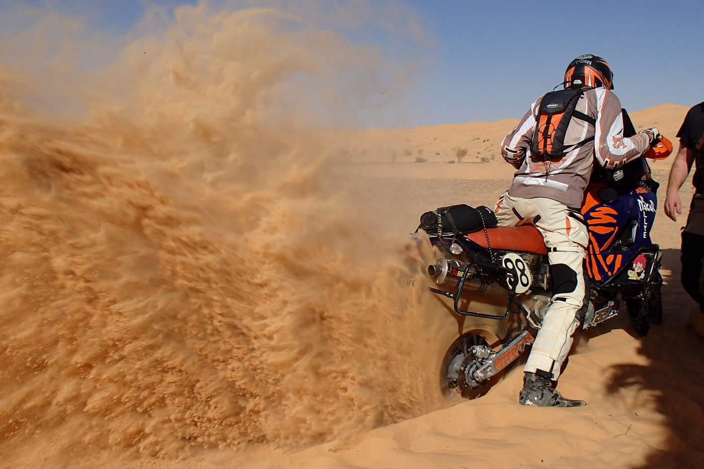
8. Transport network in Namibia
In Namibia, as in all neighboring countries except Angola, there is left-hand traffic. The Namibian road network covers about 45,000 kilometers, is well developed, and provides access to all inhabited areas of the country. However, 80 percent of the road network consists only of gravel tracks with a gravel bearing layer, which are maintained regularly or as needed with a grader. Only the national roads, some main roads, and the most important urban roads (about 6700 kilometers) are asphalted. With up to 700 traffic fatalities per year, Namibia is one of the most accident-prone countries in the world.
Rail transport on the 2,600 km network in Namibia is mainly responsible for freight transportation. Although the rail network in the south is connected to the South African railway line, passenger transportation by the Namibian railway company TransNamib hardly plays a role. Instead, intercity buses travel between the larger towns.
There are regular flight connections from Windhoek to the main towns of the country, such as Keetmanshoop, Katima Mulilo, or Lüderitz, as well as to international destinations, which are operated, among others, by the state airline Air Namibia.
Namibia's two deep-water ports are located in Walvis Bay and in Lüderitz.
9. Cities and regions in Namibia
Namibia has been divided into fourteen administrative regions since 2013, each with its own regional administration with only limited powers. The regions are called Karas, Zambezi, Otjozondjupa, Omusati, Oshana, Oshikoto, Ohangwena, Hardap, Kunene, Erongo, Omaheke, Khomas, Kavango West and Kavango East.
The most important cities in Namibia are:
Windhoek
With 320,000 inhabitants (2023), Windhoek is the capital and the political and economic center of Namibia and is considered a model social model of an African metropolis due to social security and the coexistence of the Namibian population groups. The cityscape is characterized by modern architecture and Wilhelmine buildings from the German colonial era. On a cultural level, German influence can be perceived; the carnival and Oktoberfest are fixed components of the annual event calendar. Architectural sights in Windhoek include the Old Fortress, which houses the National Museum of Namibia, the colonial buildings on Independence Avenue, the Maria Cathedral, the three city castles Heinitzburg, Schwerinsburg and Sanderburg, and the Tintenpalast, where the parliament is housed. The Tukondjeni Market is also worth a visit.
Lüderitz
The Namibian port city Lüderitz is located on the Atlantic coast in the southwest of the country in Lüderitz Bay. The name goes back to the Bremen tobacco merchant Adolf Lüderitz, who in 1883 acquired land on the bay then still called Angra Pequena in order to search for mineral resources.
The city has about 12,500 inhabitants on an area of 16 km² and has one of the two deep-sea ports in Namibia.
Many buildings and facilities in the city date from the Wilhelmine imperial era and are built in the Art Nouveau style. During the 1990s, entire streets were generously restored and today offer a beautiful insight into Namibia’s colonial history. Among the nine national monuments located in Lüderitz are the train station, the Felsenkirche (Rock Church), the Goerke House, the Kreplin House and the building of the former German Africa Bank. Ten kilometers from Lüderitz is the formerly wealthy settlement of Kolmanskuppe, thanks to rich diamond deposits, which is now a ghost town.
The seaside location of the community offers some charming coastal sections, for example the large bay located to the south, beyond Griffith Bay or the sandy coves, beaches and lagoons of the Lüderitz Peninsula. Worth seeing are the stone cross at Diaz Point or the penguins and flamingos around Halifax Island.
.
Swakopmund
Swakopmund is located on the Namibian South Atlantic coast, directly north of the mouth of the Swakop River. In the former most important port city for German immigrants, today about 44,700 inhabitants (2023) live on an area of 196 km². The city of Swakopmund is today Namibia’s most popular holiday resort. The city center is a tourist magnet with architectural gems of the Wilhelmine style and elements of Art Nouveau. Attractions in Swakopmund include the lighthouse, as a landmark of the city, the Swakopmund Museum with exhibits in archaeology, mineralogy, botany, prehistory and early history and the German colonial history of Namibia, the Imperial District Court, the Hohenzollern House, the Woermann House, and the steam engine from the colonial period. The mild coastal climate makes the city a popular excursion destination and seaside resort on the South Atlantic, especially during the months of October to March.
Walvis Bay
Walvis Bay is located on the central Atlantic coast of Namibia and is the country’s most important seaport. On an area of about 32.5 km² about 62,000 people live here (2023). The pleasantly mild coastal climate makes the city and its surroundings a popular tourist destination on the South Atlantic, especially during the months of October to March. Worth seeing is the Rhenish Mission Church and the Hope Locomotive Railway Museum. Near the city are a number of worthwhile excursion destinations such as the lagoon with important mudflats and bird colonies or the guano platform Bird Island.
10. Culture and Sights in Namibia
Namibia's main attractions include the numerous national parks and protected areas, which, in addition to wildlife and plants, also provide an excellent insight into the diversity of Namibia's landscapes.
A trip to the Fish River Canyon landscape conservation area is highly recommended. At about 160 kilometers long, up to 27 kilometers wide, and up to 550 meters deep, it is the largest canyon in Africa and the second largest canyon in the world. Multi-day hikes through the canyon are popular here.
Twyfelfontein is a valley with a source of the same name in the Kunene region, which was originally inhabited by the Damara.
Here you can marvel at the oldest evidence from Namibia's past in hundreds of rock paintings and engravings, which originate from cultures of the Middle and Late Stone Age and are among the oldest ground-bound depictions in Africa. Since 2007, the site, which was used for religious rituals for thousands of years, has been a UNESCO World Heritage Site.
In the capital, as well as in other places of significance during the German colonial period, many architectural monuments in the prevalent Wilhelminian and emerging Art Nouveau styles have been preserved.
The cultural diversity of Namibia, whose inhabitants, like those in South Africa, refer to their country as a rainbow nation, is based on the multicultural immigration dynamics that the country has experienced throughout human history and especially in recent centuries. In addition to the ancient traditions of the different African ethnic groups, German influence is also unmistakable, particularly in the style of many buildings, in the education culture, and above all, in gastronomy.
11. Public holidays with fixed dates in Namibia
| 1 Jan | New Year |
| 21 March | Independence Day |
| 1 May | Labour Day |
| 4 May | Cassinga Day |
| 25 May | Africa Day |
| 26 Aug. | Heroes' Day |
| 10 Dec. | International Human Rights Day |
| 25 Dec. | Christmas |
| 26 Dec | Boxing Day |
12. Medical information for Namibia
For legal reasons, as a tour operator, we are not permitted to give binding medical advice for Namibia and therefore refer you to the information provided by the German Federal Foreign Office, the Robert Koch Institute and the German Society for Tropical Medicine and International Health (DTG) e.V.
13. Travel information for Namibia
Current travel and safety advice, information on entry and exit requirements, as well as special criminal law information and behavioral recommendations for your stay in Namibia can be obtained from the German Federal Foreign Office.
14. Foreign representation in Namibia
| Embassy of the Federal Republic of Germany in Antananarivo | |
| Jurisdiction/ Consular district: |
Namibia |
| City: | Windhoek |
| Street address: | Sanlam Centre, 6th Floor, Independence Ave 145, Windhoek |
| Postal address: | Embassy of the Federal Republic of Germany, P.O. Box 231, Windhoek/Namibia |
| Phone: | (+264 61) 27 31 00 or (+264 61) 27 31 33 |
| Fax: | (+264 61) 22 29 81 |
| E-Mail: | Contact form |
| Website: | http://www.windhuk.diplo.de |
| Official languages in the host country: |
English |
| Embassy of the Republic of Namibia in Berlin | |
| City: | Berlin |
| Street address: | Reichsstraße 17 |
| Postal address: | Reichsstraße 17, 14052 Berlin |
| Phone: | 0 30 254 09 50 |
| Fax: | 0 30 254 095 55 |
| E-Mail: | [email protected] |
| Website: | http://www.namibia-botschaft.de |
15. Information sources for Namibia
German Weather Service
Federal Foreign Office of the Federal Republic of Germany
Wikipedia