Everything you need to know about Egypt

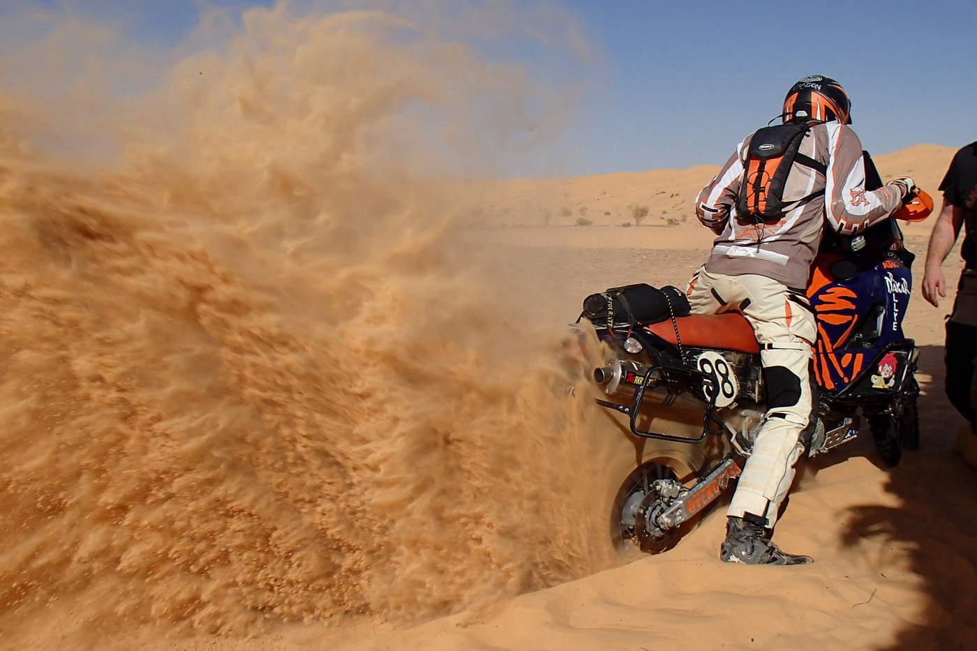
Travel map of Egypt by the tour operator Overcross
- General information for Egypt
- Climate in Egypt
- Geography in Egypt
- Flora and fauna in Egypt
- National parks and nature conservation in Egypt
- Population in Egypt
- Politics and economy in Egypt
- Transport network in Egypt
- Cities and regions in Egypt
- Culture and sights in Egypt
- Public holidays in Egypt
- Medical information for Egypt
- Travel information for Egypt
- Foreign representation in Egypt
- Information sources for Egypt
1. General information for Egypt
| Continent: | Africa |
| Geographical location: | Northeastern Africa, located in the Northern Hemisphere |
| Highest elevation: | Mount Katherine (2642 m a.s.l.) |
| Longest river: | Nile (6852 km) |
| Form of government: | Republic |
| System of government: | Semipresidential system |
| Languages: | Arabic |
| Neighboring countries: | Libya, Sudan, Gaza, Israel, Jordan |
| Capital: | Cairo |
| Area: | Approx. 1,001,500 km² |
| Inhabitants: | Approx. 109,500,000 people (2023) |
| Population density: | 109 inhabitants per km² |
| Religions: | Approx. 90% Sunni Muslims, approx. 6% followers of Christianity, as well as Jews, Baháʼís, and other religious communities not recognized by the state |
| Currency: | Egyptian Pound; 1 EUR is approximately 32 EGP. The current exchange rates can be found at oanda.com |
| Climate: | Mainly dry desert climate with regional particularities |
| Timezone: | UTC + 2 |
| Country code: | +20 |
| Country abbreviation: | EG |
| Electricity: | In Egypt, power outlets of type C are used. The mains voltage is 220V with a frequency of 50Hz. An overview of outlets and plugs used in our travel destinations can be found at wikipedia.de |
2. Climate in Egypt
Egypt is located within the North African dry belt and mostly has a desert climate with very little rainfall as well as considerable seasonal and daily temperature fluctuations. Only the Mediterranean coast and the Nile Delta are influenced by the Mediterranean climate with 100 - 200mm of winter precipitation.
The average daily temperatures in July can reach up to 31°C in Port Said, 35°C in Cairo, and over 40°C in Aswan, with very strong cooling at night. However, due to the low relative humidity of about 30%, the heat is quite bearable. In January, the average daytime temperatures drop to 20°C in Cairo and 24°C in Aswan. From March to June the hot Khamsin blows, a sand and dust wind coming from the south.
In Egypt, five more specific climate zones can be distinguished depending on the geographical location.
The approximately 700 km long Mediterranean coast and the Nile Delta are characterized by very hot summers and mild winters with relatively abundant rainfall of up to 200mm/year. Spring, as well as autumn, is hot and dry with possible temperatures over 40°C. In summer, daytime temperatures between 28 and 32°C are reached, and there is no more rainfall. The humidity is relatively high all year round at 60–75%. In summer, the sea, with temperatures of up to 28°C, invites you to swim, while in winter it cools down to 16–18°C.
The lower Nile Valley from Cairo to Asyut is also characterized by mild winters with daytime temperatures of 18–22°C; however, the summers are hotter than in the Nile Delta and on the Mediterranean coast with possible peak temperatures up to 48°C and almost no precipitation all year round, with a noticeably reduced humidity of 40–60%. In the winter nights, however, it can become quite cold with morning frost.
In the upper Nile Valley, as well as in the eastern and especially western desert areas and oases, the winters are likewise mild with cool nights, spring and autumn are very short and warm, and the long summers are very hot and extremely dry and dusty. Average daytime values reach 38–42°C, with heat waves able to cause temperatures over 50°C.
In the coastal areas on the Red Sea, in contrast, mild to warm winters prevail with very moderate temperatures between 20°C during the day and 10–13°C at night. The also very hot summers, however, do not quite reach the peak temperatures as in the neighboring desert areas. The sea, at around 20–29°C, invites you to swim year-round.
Due to its higher elevations, winters in the mountains of the Sinai Peninsula are very cool with 12–15°C during the day and 0–5°C at night. Spring and autumn are somewhat longer, but summers are nevertheless very warm with daytime temperatures up to 32°C. At night, however, the values drop to a cooler 15–18°C. Otherwise, there is hardly any notable precipitation and only low humidity.


3. Geography in Egypt
Egypt’s national territory between the Mediterranean and the Red Sea has an almost square shape and is bordered in the west by Libya, in the south by Sudan and in the northeast by Gaza, Israel and Jordan. The landscape alternates between the northern coastal area shaped by steppe and thorn savanna, deserts, semi-deserts, many oases, sea areas, and the river landscape of the Nile, which forms the main lifeline of the otherwise inhospitable desert regions south of the capital Cairo. Apart from some oases and small ports on the coasts, Nile water is the sole basis for agriculture and settlement along its fertile riverbanks. The area of this fertile river zone accounts for about five percent of the country’s area, which exceeds 1.1 million km², and forms one of Egypt’s five landscape types.
The Mediterranean coast is characterized by gently undulating dunes, which in the Nile’s delta area transition into a fertile cultural landscape crisscrossed with numerous estuaries and canals. Of the five river arms documented in ancient writings, which the Nile developed in its delta, only the two named after their adjacent cities in the delta area—the Rosetta and Damietta branches in the west and east of the Nile Delta—have remained. The other river branches and estuaries have fallen victim to extensive hydraulic engineering measures over the course of history. Due to interventions in the Nile’s natural water retention and the resulting upstream dams since the beginning of the 1900s, today the Nile no longer carries enough sediment to its delta, resulting in a gradual loss of the delta area along the seacoast.
The Libyan Desert west of the Nile occupies around two-thirds of Egypt’s national territory. The vast and relatively flat plateau land of the Libyan Plateau, which reaches up to 241 m in Egypt, descends in the Qattara depression, filled with salt marshes, to as low as 133 m below sea level. In the southwest of Egypt, by contrast, the sand and dune landscape, interrupted only by isolated basins and oases, rises up to 1098 m. Around 100 km southwest of Cairo is the 1827 km² large Fayyum Basin, a basin-like oasis landscape in whose northern part lies Lake Qarun.
The Arabian Desert east of the Nile is dominated by a mountain range deeply furrowed by wadis, which in the central section reaches more than 2000 m in height and forms the western part of an upwelling zone that continues on the Sinai Peninsula. The central part of this mountain range collapsed in the course of geological history and now forms the over 1000 m deep trench of the Red Sea, which in turn is part of the East African Rift System extending far south to Mozambique. The coast of the Red Sea is mostly lined with rugged rocky landscapes and offshore coral reefs.
The Sinai Peninsula contains Egypt’s highest elevation, Mount Catherine (Jabal Katrina), which rises to 2637 m above sea level, and is surrounded by the Gulf of Suez and Gulf of Aqaba. The Suez Canal, completed in 1869, since then forms an artificial waterway from the Red Sea to the Mediterranean.

The famous Pyramids of Giza in Egypt
4. Flora and Fauna in Egypt
Large parts of Egypt have, due to the desert-like land surface and climate conditions, no plant cover at all, apart from a few sporadically growing tamarisks, acacias and thorn bushes. Where the desert turns into desert steppe, some tough grasses can develop.
In the fertile areas along the banks of the Nile, Nile acacias, date palms, mulberry figs and carob trees as well as introduced casuarinas cluster together. Typical of the Nile delta are lotus fruits, bamboo cane and reed plants. The papyrus bushes once cultivated here in antiquity have largely disappeared. Of the vegetation originally present in Egypt, barely anything remains due to the continuous exploitation and agriculture since ancient times.
The fauna of Egypt is especially rich in water birds such as herons, cranes or Egyptian geese, which are at home on the Nile and in its delta area. During the winter months, many European migratory birds join them. Among birds of prey and scavengers, kites, lammergeiers and hawks are native. In addition to the domesticated camels, donkeys, sheep and goats, jackals, hyenas, fennecs and wild cats are among the country’s larger mammal species. In the mountainous regions, Syrian ibexes can be found. The desert is enlivened by hares, jerboas, several species of lizards and scorpions. Caution is advised in the rural Nile meadows because of the poisonous Egyptian cobra. Some crocodiles still live at Lake Nasser. More than 190 different fish species have been registered in the Nile and in the lakes along the delta coast.
5. National Parks and Nature Conservation in Egypt
In Egypt, three national parks have been designated, all of which are distributed along the coast of the Red Sea.
The Gebel Elba National Park, which covers an area of 35,600 km², is located far in the south in the politically disputed Hala’ib Triangle and, along with mangrove areas and coral reefs, is home to Egypt's only natural forest cover.
Located at the southern tip of the Sinai Peninsula on an area of 480 km², the Ras Mohammed National Park is mainly known among divers for its impressive marine inventory.
Finally, the Wadi al-Gimal National Park offers a predominantly desert landscape with a lively desert fauna over an area of 7,450 km². Within the area of the national park there are several shipwrecks which have become popular destinations for sport divers.
6. Population in Egypt
Despite the country's large area of over 1.1 million km², the settlement areas of the Egyptian population are predominantly located along the Nile and the coasts, which is understandably due to the inhospitable nature of the desert-like regions of the rest of the country. The oases are also sparsely populated due to the complex infrastructural requirements. Therefore, the purely statistically determined, moderate population density of 109 inhabitants per km² is quickly put into perspective when Egypt's total population is related to the approximately 10% possible settlement area of the country. The region around the Nile is one of the most densely populated areas in the world, with an estimated population growth of nearly 2.5% per year and an average age of 24 years.
About 91% of the population are descendants of the ancient Egyptians. Over time, however, they have been culturally and linguistically Arabized through immigration and intermixing. The sedentary, farming Fellahin and the Christian Copts, who mainly live in Upper Egypt and in the cities, are considered unmixed descendants. In addition, Italians, Turks, Abkhazians, and Britons have settled in the coastal northern region of Egypt.
In southern Egypt and in the major cities, there is still a Nubian minority. A few descendants of the former Berber tribes still settle today in the oases of the Libyan Desert, which is also inhabited by nomadic Arab Bedouins. Beja-speaking nomads live in the Arabian desert regions east of the Nile.
The official language in Egypt is Arabic. However, as a local mother tongue, a modern dialect, Egyptian Arabic, is predominantly spoken. In the Coptic Church, Coptic is still used as the liturgical language. In southern Egypt and in the Kharga Oasis, many people speak Nubian. In the Siwa Oasis, people still speak the Berber language Siwi, and there are also Domari speakers and, in the southeast of the country, Beja speakers.
As a foreign language, French is common among the Egyptian upper class, and more recently primarily English. Due to the large community of Italian Egyptians in Alexandria, Italian was the city's lingua franca until the 20th century.
7. Politics and Economy in Egypt
According to the constitution, Egypt is an Islamic state in which Sharia law has been the main source of legislation since 1980.
Following the new constitution approved by referendum on January 16, 2014, the presidential republic previously declared in Egypt became a semi-presidential unitary state, which prohibits the formation of religiously motivated political parties and grants the military a special political status. Compared to previous constitutions, the new constitution contains an expanded catalog of fundamental rights, guarantees equality between men and women, and protects the Christian minority in the country.
The president is the head of state and commander-in-chief of the armed forces, appoints the prime minister and members of the cabinet as well as the governors, the high judges, and officers. He also has veto power in legislation, can issue decrees, and dissolve parliament. He is elected through free elections with several approved candidates. The unicameral parliament of Egypt, established by the new constitution, consists of the People's Assembly with 596 members.
After South Africa, Egypt is one of the strongest industrial locations in Africa. In addition to the industrial processing of agricultural products such as cotton and sugar, the production of cement, fertilizers, iron, steel, and aluminum, the manufacture of electrical and chemical-pharmaceutical products, as well as oil processing and machine or vehicle construction, have become important industries in Egypt. The Egyptian company Asfour Crystal International is the world market leader in the field of special lead crystal products.
Egypt's most important natural resource is oil, which is mainly extracted in the Gulf of Suez, the Qattara Depression, and the Sinai Peninsula. In addition, raw phosphates, iron and manganese ores, and salt are extracted. Deposits of asbestos, sulfur, nonferrous metals, and uranium ores are still awaiting development.
In addition to industrial production, agriculture continues to play an important role in Egypt as an employer. However, Egypt’s main sources of income are the revenue from oil exports and the use of the Suez Canal, as well as remittances from guest workers and tourism. The gross domestic product per capita was 4,150 EUR in 2022, and economic growth was 6.7 percent.
8. Transportation network in Egypt
The Egyptian road network has a total length of almost 70,000 km and is primarily limited to the Nile Valley and the Nile Delta. Two thirds of the roads here are paved and the main roads are well developed. Longer stretches on Egypt’s secondary roads, on the other hand, can become uncomfortable due to numerous potholes and crossing sand dunes. The remaining parts of the country are only accessible by desert tracks. A road tunnel under the Suez Canal connects the core region of Egypt with the Sinai Peninsula. Traffic in the cities of the country is described in many travel reports as confusing chaos. In fact, Egypt is among the countries with the most traffic accidents. Safety regulations and traffic behavior do not meet European standards.
The most important means of transportation in Egypt is still the railway. The rail network of the Egyptian State Railways along the Nile and its delta has a route length of about 7,700 km and is the oldest in all of Africa. The Alexandria–Cairo–Luxor–Aswan route is operated daily with air-conditioned sleeper trains. A comfortable express train also connects Cairo with Marsa Matruh near the Libyan border. Ticket prices for commuter trains and in third class are subsidized by the state. Alongside passenger traffic, freight transport by rail, with four to five million tons per year, also has significant importance for Egypt’s industrial development.
The largest seaport is Alexandria on the Mediterranean, alongside Port Said and Port Taufiq near Suez on the Red Sea. The 162 km long connection from the Mediterranean to the Red Sea through these two seaports via the Suez Canal plays an important and international role. Together with the Nile, about 3,350 km of inland waterways are navigable, which handle 25% of freight transport.
International airports are located in Cairo, Alexandria, Marsa Alam, and Luxor.
9. Cities and Regions in Egypt
Egypt is divided into 27 governorates of very different sizes, each governed by a governor with the rank of minister. While the desert areas are administered in large governorates such as the district of Al-Wadi al-Jadid with an area of 376,000 km², the densely populated areas along the Nile are divided into much smaller administrative districts, the smallest of which is the Luxor Governorate, surrounding the city of the same name on the Nile, with only 55 km².
The largest urban metropolitan regions in Egypt are Cairo and Giza with a combined population of about 16.6 million, Alexandria with about 5.5 million, and the urban areas of Suez and al-Mansura, each with around 600,000 inhabitants. A third of the Egyptian population is concentrated in these regions.
Cairo
The capital Cairo is the political, economic, and cultural center of Egypt as well as the entire Arab world. The core city alone is home to over 10 million people on an area of about 600 km². The metropolitan region around Cairo, which also includes the cities of Giza and Shubra al-Khaima, is, with over 16.6 million inhabitants, the largest urban agglomeration on the African continent. In addition to being the seat of the Egyptian government, parliament, all state and religious central authorities, and numerous diplomatic missions, Cairo is also Egypt's most important transport hub and has numerous universities, colleges, theaters, museums, as well as a large number of architectural monuments. The historical roots of the city go back to the founding of a military camp by the Fatimids around the year 970 AD. In addition to the many culturally and historically significant buildings in Cairo such as the Citadel, the Muhammad Ali Mosque, or the city gates, the entire Islamic old city of Cairo has been included by UNESCO on the World Heritage List. Also worth seeing are the necropolises built according to the pharaonic funerary cult, the inhabited cemeteries of Cairo, as well as a series of architectural monuments from more recent times such as the Stock Exchange, the Sednaoui residential building, or the Mubarak Library by French architect Georges Parcq at the beginning of the 20th century. In neighboring Giza, the famous pyramids and the Sphinx are among the most famous structures of humanity and the last surviving wonder of the ancient world.
Alexandria
With over 5.5 million inhabitants, Egypt's second largest city lies at the western edge of the Nile Delta and was founded around 331 BC by Alexander the Great on the site of the ancient Egyptian settlement Rhakotis on the Mediterranean. Alexandria was long considered the intellectual center of the ancient world. Many historical buildings and art treasures have been lost over the centuries in the conquest-filled and turbulent history of Alexandria. Today's cityscape is characterized by buildings in the styles of historicism, Stile Liberty, and eclecticism from the 19th and 20th centuries. Remnants from ancient times include a Roman theater and the catacombs of Kom esch-Schuqafa. The most important museum in Alexandria is the Greco-Roman Museum, covering ancient architecture, sculpture, and craftsmanship. Under the patronage of UNESCO, the cultural center Bibliotheca Alexandrina was built to revive the illustrious past of the ancient library. The site houses the library, museums and galleries, several research institutes, an event center, and a planetarium. Besides its cultural and historical significance, Alexandria is today, after Cairo, the second largest industrial city in Egypt.
Port Said
Located on the Mediterranean at the entrance to the Suez Canal, the city is, after Alexandria, Egypt's second most important port. With about 750,000 inhabitants, Port Said is both an industrial location and an important transshipment point for agricultural products such as cotton and rice, as well as a major seaside resort and a stopover for international cruise ships. Together with the Suez Canal, the city is officially considered the boundary between the African and Asian continents.
Luxor
The Upper Egyptian city of Luxor lies on the southeast side of an approximately 120-kilometer-long bend of the Nile and, with just under 500,000 inhabitants, is known less for its size than for its cultural and historical significance. In and around Luxor are some of Egypt's most important archaeological sites. Especially well known are the Luxor and Karnak temples in and north of the urban area, as well as the Valley of the Kings and the ancient Egyptian temple ruins in Thebes-West on the west bank of the Nile. The Nile serves as a major transport axis, with many cruise ships running from Luxor as a starting or ending point to Aswan in the south and north as far as ancient Abydos. The ship docks are located on the promenade within the city along the entire eastern Nile bank.
Hurghada
Hurghada, with about 220,000 inhabitants, is the largest Egyptian tourist center on the Red Sea. In the well over 30-kilometer-long coastal region with white palm-fringed sandy beaches and coral reefs, numerous hotel complexes and facilities offering tourist activities such as diving, snorkeling, windsurfing, sailing, and deep-sea fishing have been established. The resort town of Sharm el-Sheikh at the southern tip of the Sinai Peninsula, opposite Hurghada, is particularly popular among divers.

Temple of Hatshepsut in Thebes, Egypt
10. Culture and Sights in Egypt
Ancient Egypt was one of the first civilizations of humanity, and the associated cultural history of Egypt dates back over 6000 years, during which Egypt influenced later cultures in Europe, the Middle East and Africa. After the Pharaonic era, Egypt itself came under the influence of Hellenism, Christianity, and Islamic culture. Today, many aspects of ancient Egyptian culture are still present and interact with newer elements, including the influence of modern Western culture.
Cairo has been one of the spiritual and cultural centers of the Arab world for centuries, being home to the prestigious Islamic university al-Azhar and the leader of the Coptic Orthodox Church. It houses large libraries, museums, and the first opera house in the Arab world, as well as large parts of the Arab film industry. Numerous galleries, exhibition spaces, music labels, and venues, often located in vacant buildings in the magnificent yet dilapidated downtown, offer a varied program and are closely connected with the international cultural scene. Major cultural events include the Cairo International Book Fair, the International Film Festival, and the International Festival for Experimental Theater. In addition, there is still an active independent cultural scene.
Egyptian music is a rich mix of indigenous, Mediterranean, African, and Western elements. Percussion and vocal music have always been an important part of local musical traditions at weddings and other celebrations, while Egyptian pop music has gained increasing cultural significance in the more recent music scene.
In keeping with Egypt’s historical significance, the country is rich in cultural-historical sites, above all the pyramids around and in the greater Giza area and the temples of Luxor or the nearby Valley of the Kings in Thebes. Monuments to Egypt’s more recent history can mainly be found in Cairo and Alexandria.
Nature lovers can gain interesting insights into the desert and steppe landscapes of the eastern Sahara, as well as the maritime world of the Red Sea coastal regions, in Egypt’s three national parks.
11. Public holidays with fixed dates in Egypt
The date of the Islamic holidays is determined according to the Islamic lunar calendar and therefore shifts from year to year
| 1 Jan | Bank holiday |
| 7 Jan | Coptic Christmas |
| 25 Jan | Anniversary of the 2011 Revolution |
| 25 Apr | Sinai Liberation Day |
| 1 May | Labour Day |
| 1 Jul | Bank holiday |
| 23 Jul | Anniversary of the 1952 Revolution |
| 6 Oct | Armed Forces Day |
12. Medical Information for Egypt
For legal reasons, as a tour operator we are not permitted to provide binding medical advice and therefore refer to the information from the Federal Foreign Office of the Federal Republic of Germany, the Robert Koch Institute, and the German Society for Tropical Medicine and International Health e.V.
13. Travel information for Egypt
Current travel and safety information, details on entry and exit requirements as well as special criminal law information and behavioral recommendations for your stay in Egypt can be obtained from the Federal Foreign Office of the Federal Republic of Germany.
14. Representation abroad in Egypt
| Embassy of the Federal Republic of Germany in Cairo (there is also an honorary consulate in Alexandria) | |
| Jurisdiction/ Consular district: |
Egypt. |
| Location: | Cairo |
| Street address: | 2 Sharia Berlin (off Sharia Hassan Sabri), Zamalek, Cairo |
| Mailing address: | Embassy of the Federal Republic of Germany, 2 Sharia Berlin (off Sharia Hassan Sabri), Zamalek, Cairo 11211, Egypt |
| Telephone: | (00202) 2728-2000, for emergencies in German and English (0020) (0)122 213-6538, Arabic (0020) (0)122-2308151 |
| Fax: | (00202) 2728-2159 |
| E-Mail: | [email protected] |
| Website: | http://www.kairo.diplo.de |
| Official languages in the host country: |
German, English, Arabic |
| Embassy of the Arab Republic of Egypt in Berlin (There are also honorary consulates in Frankfurt and Hamburg) |
|
| Location: | Berlin |
| Street address: | Stauffenbergstraße 6/7 |
| Mailing address: | Stauffenbergstraße 6/7, 10785 Berlin |
| Telephone: | 030 4 77 54 70 |
| Fax: | 030 4 77 10 49 |
| E-Mail: | [email protected] |
| Website: | http://www.egyptian-embassy.de |
15. Information sources for Egypt
German Weather Service
Federal Foreign Office of the Federal Republic of Germany
Wikipedia